


Preview
Publication Date
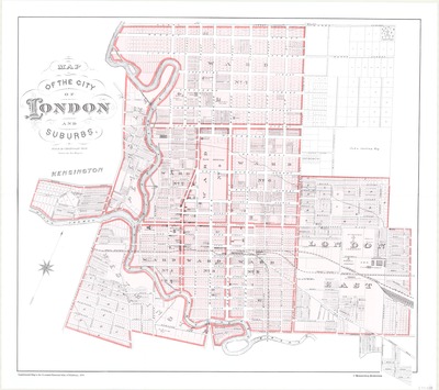
1878
Publisher
Hammerburg Productions
Scale
10 chains = an inch
Geographic Area
London (Ont.)
Description
Map of the city of London and suburbs, originally a supplemental map to the Illustrated Historical Atlas of Middlesex, drawn by John Rogers.
Physical size
74 x 65 cm
1351101.jpg (519 kB)
Notes
"Drawn by Jno Rogers."
"Supplemental Map to the Illustrated Historical Atlas of Middlesex, 1878"
Map reproduction 2009.