
Preview
Publication Date
1800
Scale
10 chains to an inch
Geographic Area
London (Ont.)
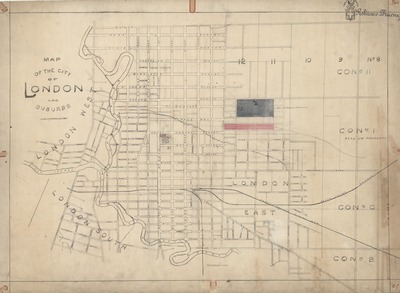
Description
Map of the City of London and Suburbs
Physical size
68 x 94 cm
CX67.jpg (365 kB)


1800
10 chains to an inch
London (Ont.)
Map of the City of London and Suburbs
68 x 94 cm
Notes
Publication date unknown.
"Proposed site for ... Infantry School" coloured green, total area approximately 54 1/2 acres.
Red coloured area likely Canadian Pacific railyards.
"Trademark Reliance tracing."