


Preview
Publication Date
1800
Publisher Location
London, Ont.?
Publisher
City of London, Ont.?
Scale
Plan: 200 feet = 1 inch; Profile: Horizontal 400 feet = 1 inch; vertical: 20 feet = 1 inch
Geographic Area
London (Ont.)
Map Theme
Railroads
Map Type
Blueline drawing
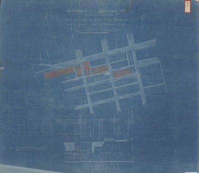
Description
Map of the Ontario and Quebec Ry. Detroit Extension Plan and Profile of Right-of-way Through the City of London, West of Richmond Street.
Physical size
53 x 60 cm
CX605.jpg (308 kB)
Notes
Publication date unknown, sometime after 1883.
Includes notes about land transactions and deed ownership.
Drawings show profile of road bed and map of planned railroad locations.
"Land shaded with diagonal red lines stands in name of Joint Trustees."
Photo reproduction of blueline map.
53 X 60 CM.