


Preview
Publication Date
1850
Publisher Location
Place of publication not identified.
Publisher
Nath. Steevens
Scale
2 inches to a mile
Geographic Area
London (Ont.)
Map Type
Drawing
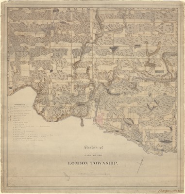
Description
Sketch of part of the London Township with references for roads (including road quality, e.g. "Practicable for Troops & Guns at all Seasons"), bridges, houses, farms (with owners' names), churches, barracks and artillery, businesses, etc.
Physical size
68 x 65 cm
CX1007.jpg (562 kB)
Notes
Map oriented with north to the upper right
"Nath. Steevens, Lt. XX Regt., 1850."