


Preview
Publication Date
1900
Publisher Location
London, Ont.
Publisher
Frederick Henry
Scale
200 feet = 1 inch
Geographic Area
London (Ont.)
Map Type
Blueprint
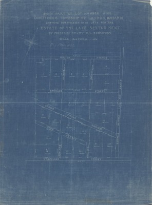
Description
South Part of Lot Number ine, Concession C., Township of London, Ontario, showing subdivision into lots for the Estate of the Late Sextus Kent, by Frederick Henry O.L. Surveyor.
Physical size
61 x 45 cm
C952.jpg (255 kB)
Notes
Map oriented with north to the upper right.