


Preview
Publication Date
12-31-1824
Publisher Location
Port Talbot (Ont.)
Publisher
Surveyor Office, Port Talbot (Ont.)
Scale
Forty chains to one inch
Geographic Area
London (Ont.)
Map Type
drawing
Description
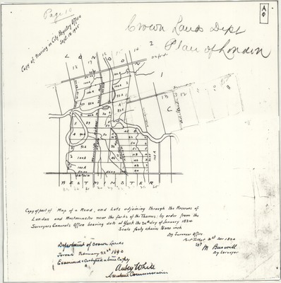
"Copy of tracing in City Registry Office Sept. 18, 1905"
"Department of Crown Lands, Toronto, February 22nd 1890. Examined and certified a true copy. Aubrey White, Assistant Commissioner."
"Copy of part of Map of a Road, and lots adjoining through the Reserves of London and Westminster near the forks of the Thames: by order from the Surveyors General Office bearing date at York the 24th day of January 1824"
Physical size
32 x 32 cm
2105601.jpg (319 kB)