


Preview
Publication Date
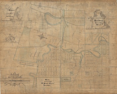
1840
Scale
13 chains to an inch
Geographic Area
London (Ont.)
Map Type
colour drawing
Description
Map of London, Canada West, dated 1840 & 1841, includes measurements of lots, names of some landowners, "Glebe belonging to St. Paul's Church", and other landmarks.
Physical size
45 x 58 cm
CXX11.jpg (492 kB)
Notes
Map oriented with north to lower right.
"Drawn by Wm Robinson."